Trip Report: Ruidoso Expedition
- Mick Sudano

- Oct 29, 2021
- 5 min read

Early October is a special time of year around Ruidoso, New Mexico. The heat mellows, nights become cool, and the leaves change color in the mountains. This is when we teamed up with a small group of friends to ride a modified version of the Billy The Kid route for 70-ish miles on a 3-day expedition. Odis and Mick arrived a day early. Jesse hit town mid-morning on Friday and we took the opportunity to remove the doors and roof from the Jeep and scout the route while caching water at pre-selected camp areas along the way. We arrived back in town covered in a layer of fine dust from head to toe - smiling from ear to ear. We started packing gear on bikes, and lubing chains Friday just as other riders were beginning to show up. We ordered a couple of delicious pizzas from local Cafe Rio Pizza and shared a few beers while packing up our bikes for the Saturday departure.

Day 1.
Saturday morning we met for an early breakfast at Denny’s. It was the perfect Fall weather for a bikepacking trip. Sunny with a light wind and temps in the '60s. After breakfast, we drove our convoy to the ranger station where we planned to leave our vehicles. After getting the bikes ready and posing for a quick horse and rider shot, we started the route. This version had us begin with a fun 18 mile downhill section eastbound along Hwy 70. We were lucky enough to have a tailwind the entire stretch which resulted in top speeds around 35 mph on fully loaded bikes. We stopped briefly at the Billy the Kid roadside memorial for a photo op.


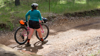
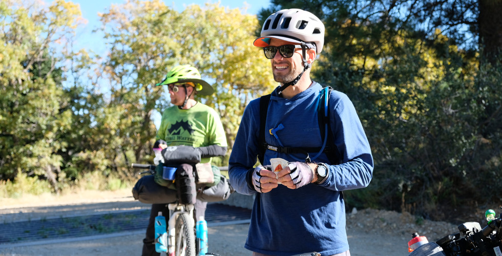
After a few more miles, we turned off the pavement and started the 5-mile climb gaining around 1,000 feet towards Fort Stanton. The temperature warmed into low 80 as we worked our way up the dusty switchbacks. As riders spaced out to work the climb at their own pace, those in the back would round the corner to find the leaders waiting in a small spot of shade. This dirt road slinky continued all the way to the summit. We arrived at the summit in groups of two and waited until everyone had some food and water before the fast 4-mile descent towards Fort Stanton.
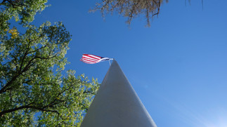
As the Fort was in sight, we stopped at the Fort Stanton Merchant Marine & Military Cemetary. Rows of white crosses and large anchors seemed out of place in this area so far from any large body of water. Further into the cemetery were the memorials of various service members from all branches and some of their spouses. We took a photo of each prior service member in our group beneath the seal of their branch before continuing our route.
After a fast mile, we arrived at Fort Stanton. We scheduled some time to explore the fort and watched a short history video provided by the staff. A few of our group made personal purchases in the gift shop and we set out on a self-guided walking tour to see some of the old buildings. Barracks, a hospital, officers' quarters, and a supply room all provided a glimpse into the daily life of past fort residents.
A little after 2 pm we set out for our last few miles. The paved section was easy and mostly downhill for about a mile before the gravel road led us into camp. Right at the end, we were gifted with a shallow water crossing opportunity at Bonito Rio Creek. As we started to get off the bikes to walk, we had a change of heart and decided to try it the fun way and attempt to ride through. About half the group made it without getting their shoes wet. The water was not deep, maybe a foot or so, but the loose round river rocks made it tough to stay upright. We shared some great laughs with a woman sitting by the creek who got to watch the show as well.

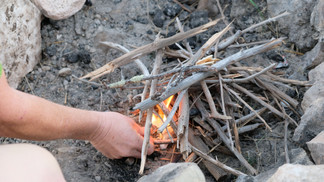
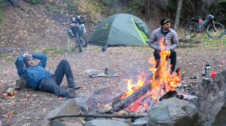
We found an open campsite at the Cave Campground east of Fort Stanton. Our total miles for the day ended at 31. We hiked down the road and hauled back our previously cached water to our site. Many walked off to return shortly after with armloads of firewood as we started cooking meals and setting up camp. Someone mentioned they could smell mint and we found some growing wild around our camp. A short-lived attempt was made at a trailside Mojito. As it got dark the fire was lit and stories were shared about previous trip highlights. A flask and some cigars made an appearance which led to standing in the dark for almost an hour talking about the amazing stars and our clear view of the Milky Way. We could see a very distant glow of car headlights going over a high mountain road and we realized that was tomorrow's route. Riders started vanishing to their respective tents and soon the fire was out and the camp was quiet.
A bull elk called nearby throughout the clear night.

Day 2
The wind started coming through the trees around 5 am. We woke to the sounds of the local bull elk somewhere nearby. Jet boils firing to life and cookware rattling could be heard from tents as headlamps started illuminating around our area. We made good time getting ready to roll and started the day with a quick and chilly ride northeast towards Hwy 380. After a brisk headwind and a few miles of climbing, we arrived in Capitan. The other patrons at the Smokey Bear Restaurant had the misfortune of witnessing us destroy 6 breakfasts in a crime scene fashion.

A cold front and rainstorm moved in while we were inside forcing us to wait about 90 minutes for most of the storms to pass. We started the climb out of town and met a hard headwind until the high point. A short break at a rest area gave us a moment to catch our breath before setting off for almost two miles of steep and fast downhill towards Nogal. The descent ended in a hard left turn onto a dirt road that begins the route to the National Forest. We rode the hilly and shaded five miles to camp where we cached water a couple of days earlier. Along the way, we passed some beautiful cabins and private property before finally crossing the line to public land. The Fall scenery and colors were nice so it was a little less noticeable that we were regaining the altitude we lost on the previous descent. Temps were dropping quickly as we made camps and lit a fire. We shared laughs at AJ using leverage between the split of a large tree to break off massive chunks of firewood from a deadfall log he carried over. The skies had cleared after the storm and it ended up being a nice night. As we were close to wrapping up the evening, we heard a mountain lion call a few times close by. We let the fire die out and headed to our tents.
Day 3
AJ left the group early to get back home. The rest of us rode out around 8:45 to start the climb to the summit of Crest Trailhead. Nearly 90 minutes later we reached the summit and high point of our route. We shared congratulatory fist bumps and a brief water break before starting the fast 12.5-mile forest road down 2000' of elevation loss to Hwy 48. We watched 2 young bull elk sprint across the road in front of us just before we reached the pavement. Once on Hwy 48, we found the climb. Each rider has to go deep inside to their happy place for that 1500' ascent in just under a mile and a half. Reaching the top of this soul crusher is rewarded with two more hill climbs before a long stretch of fast downhill back into Ruidoso. Once everyone arrived at the ranger station we passed out celebratory beers and unloaded bikes before saying our congrats and parting ways.














Comments